Turn by turn

Random point of interest
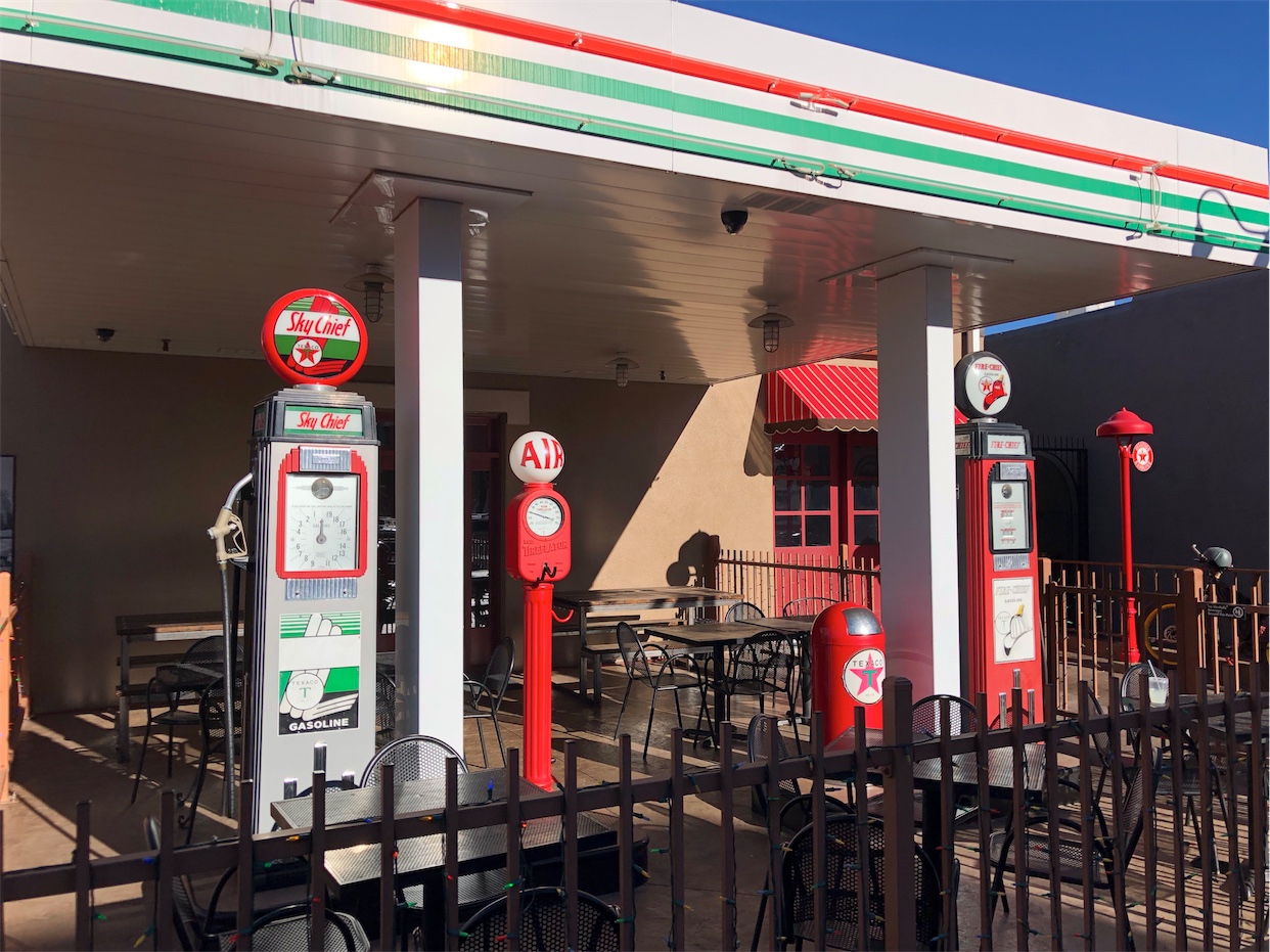
Station 66 Italian Bistro
Pizza & Italian fare with full bar plus live music, a roof deck & patio with views ...
DetailGardner – Bloomington
IllinoisPrinting this description can take a lot of time, so you might want to consider buying commercially available alternatives such as the 8 map set and the EZ66 guide.
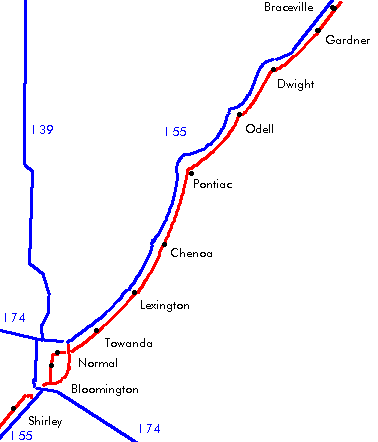
Gardner
exit Gardner on the frontage road southeast of I-55.
Route 66 is stuck between I-55 and the railroad.
Dwight
There are a number of options for passing Dwight:
X, a choice of alignments is available:
| 2-lane | 4-lane bypass |
|---|---|
|
After the Interstate veers off to the right, half a mile later, make a left turn onto Brewster Rd. to stay with the railroad. At the T intersection, make a left onto IL-47 South. Cross the Conrail railroad (east-west). Continue straight onto Waupansie St. as IL-47 turns south across the railroad. Follow Waupansie St. as it curves west and then south. Cross IL-17 (Mazon Ave.) to old 66 (south). Ambler-Becker Texaco station being restored by the community (2003). The Marathon Oil Station is a well maintained Route 66 relic, constructed in 1932, and located at 417 W. Waupansie St. The Feddersen’s Pizza Garage was a car dealership that’s been converted to a pizzeria. It’s located at 309 S. Old Route 66. The Carefree Motel is now a private residence. The former Keeley Institute -for treating alcoholics and drug addicts- was located in downtown Dwight and is known for its stained glass windows featuring the senses. Currently, the building is the William W. Fox Development Center. It is located at 134 W. main St. Dwight has a stone railroad depot built in 1891. The first national bank building was designed by Frank Lloyd Wright in 1905, located at 122 W Main St. Dwight was bypassed when Route 66 was built in 1926, as such most roadside businesses started on Route 66 a bit out of town. Pre-Route 66 road ran through town, and even some state makers from the era are rumored to be found near the cemetery. Feddersen’s Pizza Garage at 309 S Old Route 66. Curve right onto Odell Rd. Behind you on Odell Rd is a pre-Route 66 alignment (1918). Turn left onto old highway 66 at the southern end of town and continue southwest. |
Continue straight on US-66, which becomes old highway 66 as it crosses IL-47. |
|
Rejoin at the intersection of old highway 66 and Odell Rd. heading southwest on old IL-66. |
|
Odell
After the Interstate veers right, turn left on Odell Rd. into town when historic highway 66 veers away from the railroad track.
At the intersection 2nd st. continue straight on West St.
Turn next right onto Prairie St. (west).
Turn 2nd left onto S. West St. (southwest).
Across of the Saint Paul’s church, you can find the entrance to a 1937 built pedestrian tunnel under Route 66, known locally as the “subway”. The entrance was filled up in the 1950’s but the first 3 steps and the railing has been replaced in the spring of 2006 by the Illinois Route 66 Association.
Old restored Standard Sinclair gas station also known as the Odell Station located at 400 S West St. The award-winning station acts as information center but was built in 1932 and served travelers on Route 66 till it eventually closed in 1975. It’s been restored by the Illinois Route 66 Association and their preservation committee. Special thanks to John and Lenore Weiss for their time and effort to this project.
Continue on West St. (southwest).
As West St. joins old Highway 66, turn left (southeast).
Cayuga
Before Pontiac: Meramec Caverns Barn 44/66 on the right-hand side, about 0.5 miles after the road becomes a 4 lane road, turnout available. It’s also known as the Cayuga Barn.
Pontiac
Old Log Cabin Inn, at the intersection of Pontiac Rd. (2 lane 66) and the 4 lane 66 on the north edge of town at 18700 Old Rt. 66
This building wasn’t always facing this side, it originally faced the much older Route 66 alignment behind the building, but was lifted and turned 180 degrees when the alignment changed.
At the intersection with 1600 Rd., turn left onto old route 66.
Follow southeast along the railroad tracks.
Follow right onto 1830 Rd. (west).
Follow left onto Division St. (south).
Make a right onto Lincoln Av. (west).
Follow the turn south onto Ladd St (IL-23).
Turn east on Howard St. (IL-116) to Main St. to get to the Route 66 Museum that’s been built in the old firehouse (opened in June 2004).
Continue on Ladd St. as it rejoins the railroad.
An old bridge was preserved by the Illinois Route 66 Association. The bridge features an old painted sign designating it as part of IL-4 as well.
Make a right turn onto Reynolds St.
Ladd St. straight ahead dead-ends but was Route 66.
Next left onto Old highway 66 (4 lane version).
Rodino Sq. Building used to be a Pontiac attraction till 1989.
The old police headquarter, built in 1941, was located just south of Pontiac. The remarkable thing about the building is its shape: a pistol.
Ocoya
Continue on old highway 66.
Chenoa
Left onto Morehead St. (south).
Former site of Steve’s Cafe, established in 1918, gone.
Turn right (=west) onto US-24 (Cemetery Ave.).
Turn left onto 4 lane 66 (south).
Site of the former Chenoa motel.
Ghost town of Ballard, IL.
Former site of the Graham and Bennion Elevator, better known as the Ballard Grain Elevator, located in what used to be Ballard, 4 miles from Chenoa on the southeast side of the old road. It was demolished on Jan 20th, 2006.
Lexington
Turn left onto Main St. (east).
Turn 2nd right onto Grove St. (south).
Turn left onto old highway 66 (southeast).
Lexington motel (now apartments) at the intersection of Bypass 66 and Main.
Towanda
Continue on historic highway 66.
Route 66 – A geographic Journey: an abandoned stretch of old Route 66 on the north side of Lexington, walkable, built by students. It’s also known as Memory lane.
At the stop sign at the Jefferson St intersection, you have a choice:
| 4-lane | Veterans Parkway bypass |
|---|---|
|
Continue straight on Old Highway 66 (southwest) NormalBloomington
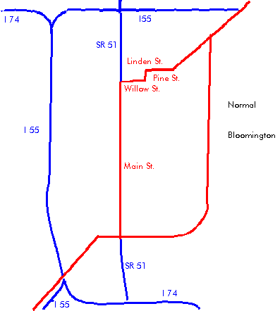
After crossing the Veterans Parkway, Old highway 66 Become Shelbourne Dr. Continue as the road veers right (west). Turn left onto Henry St. (south). Turn right on Pine (southwest). Follow Pine as it veers right (west). Turn left to Linden (south). Turn right to Willow (west). Turn left onto Main Street (south). Follow US-51 business (south) right onto Kingsley St (south). Follow US-51 business (south) as it becomes Center St. Follow US-51 business (south) as it becomes Madison St. Follow US-51 business (south) as it becomes Center St. once again. Cotton’s Village Inn at 410 N. Main in Bloomington. Former site of the first Steak ‘N’ Shake on 1219 Main St, it all started here in 1934. Side trip: Visit the Shirk Products factory, the manufacturer of Beer Nuts, at 103 N. Robinson St. Right on Business-55/Veterans Pkwy. (west). Right on Morris Ave. (north). Immediately left on Springfield Rd. (southwest). Left on Beich Rd. (west). Cross I-55. First Left (=still Beich Rd.). |
Turn right onto Jefferson St. NormalBloomingtonEnter I-55 south at exit 171. Take exit 167 south to Veterans Pkwy. (Business-55). Rejoin I-55 south. Take exit 154 to Shirley. |
