Turn by turn

Random point of interest
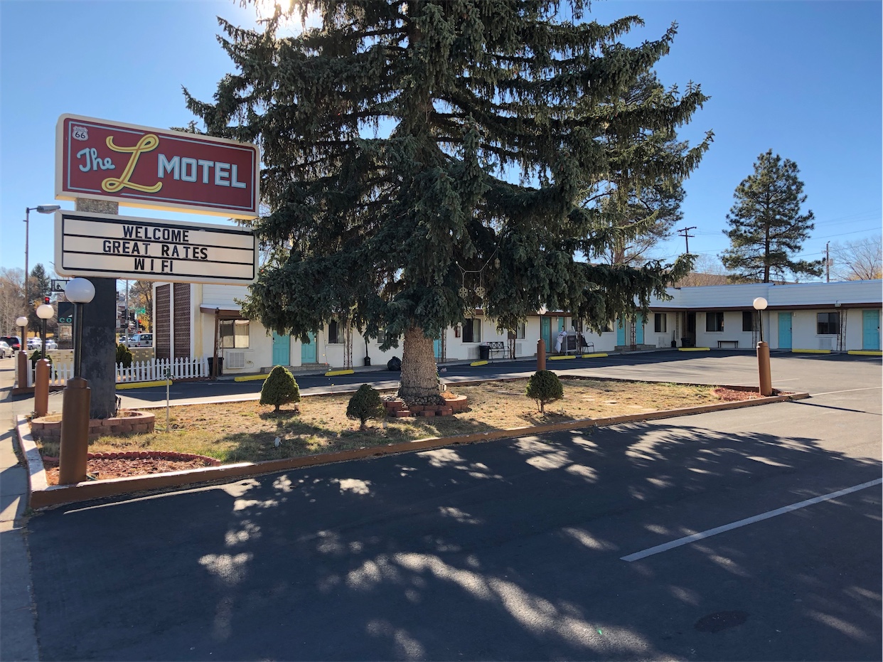
The L Motel
The L motel was built in the mid 1940's. . The complex was originally built in ...
DetailBarstow – San Bernardino
CaliforniaPrinting this description can take a lot of time, so you might want to consider buying commercially available alternatives such as the 8 map set and the EZ66 guide to take along on your trip.
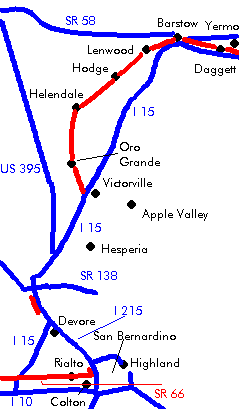
Barstow
Enter Barstow on E. Main St. (US Historic Route 66).
Turn right at Montara Rd.
Cross under I-40 at the the Montara Rd. exit.
Continue left to stay with E. Main St.
Cross over I-15 at the E. Main St. exit.
Continue straight on W. Main St. (National Ols Trails Hwy.) at the intersection with 1st Ave.
El Rancho motel, 112 E. Main St. (across from N. 1st St.), constructed from railroad ties. Check out the neon sign.
Short sidetrip: Turn north on N. 1st St. across the railroad bridge towards the restored Harvey House (Casa del Desierto). The route 66 museum is located there as well.
Continue on W. Main St. (National Old Trails Highway).
Cross under CA-58 at the W. Main St. exit.
Sidetrip: Calico Early Man Site
An archeological site 15 miles northeast of Barstow (I-15 exit Minneola Rd.). Very early stone tools have been found here.
Lenwood
Continue on National Old Trails Highway.
Continue straight at the intersection with Lenwood Rd.
Former Drive Inn theatre on the south of the road.
Hodge
Continue on National Old Trails Highway.
Helendale
Continue on National Old Trails Highway.
Helendale marker on the railroad tracks.
Sidetrip: Exotic World Museum (Burlesque).
Bryman
Continue on National Old Trails Highway.
La Delta
Continue on National Old Trails Highway.
Cross under railroad tracks.
Oro Grande
continue on National Old Trails Highway
An antique business, a landmark in it’s own right is located about half a mile beyond Oro Grande.
Cross the Mojave River.
The 1930 steel truss bridge across the Mojave River
Victorville
Continue on D St. (National Old Trails Highway).
Pass under I-15.
Route 66 Museum on the right at 16849 D St.
Turn right onto 7th St.
Follow 7th St. (US Historic Route 66).
Rogers and Dale Evans Museum used to be at 15650 Seneca Rd., now moved to Branson, MO.
Join I-15 southbound at the Palmdale Rd exit.
Leave Victorville on I-15.
The southbound lavnes of I-15 cover Route 66.
Continue on I-15 for about 20 miles.
Continue on I-15 at the Oak Hill exit.
Canjon Summit Inn is located on the east site south of the Oak Hill exit at 6000 Mariposa Rd. Features Ostrich (from a nearby ostrich farm) as well as more common items on the menu.
Cajon Summit
Use the Cleghorn Rd. exit.
From the off-ramp, turn right.
Continue left onto Cajon Blvd.
Turn right onto Cleghorn Rd. for an old segment of Route 66 (return at the tracks).
Continue on Cajon Blvd. The newer half of a once 4-lane divided alignment. The blocked half is the older original road.
Turn left at Kenwood Ave.
The dead-ending Canjon Blvd. straight ahead is Route 66 (Currently barricaded. Last updated in 2005).
Join I-15 southbound at the Kenwood Ave. exit.
There are some difficult lane changes on Interstates ahead. Especially in heavy traffic they aren’t easy to execute safely. An easier way is to drive around the I-15 – I-215 interchange. It’s not in any way Route 66, but it’s a lot easier to drive:
– Do not turn onto I-15, but cross under it and continue straight.
– Continue on Kenwood Ave. as it twists
– Make a left onto Devore Rd.
– Cross over I-215.
Cajon blvd (both ways) is Route 66. So, after exploring to the right,
– Turn left onto Cajon Bvld.
Use left lanes immediately to get to I-215.
Devore
Leave I-215 at the first exit (Devore).
At the exit, there’s a piece of Cajon Blvd to the right (0.1 miles long).
Turn left onto Cajon Blvd.
Straight across at the intersection with Glen Helen Pky. (Devore Rd.).
Continue on Cajon Blvd
Turn slight right at the Y-intersection with Kendall Rd.
Continue under the railroad
At the next Y-intersection, left to stay with Cajon Blvd.
