Turn by turn
Westbound Divernon
Printing this description can take a lot of time, so you might want to consider buying commercially available alternatives such as the 8 map set and the EZ66 guide to take along on your trip.
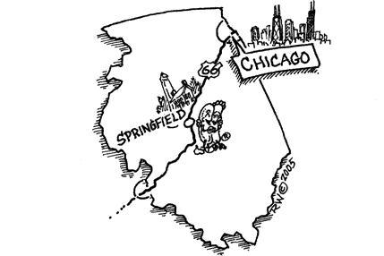
Map courtesy of Stefan Joppich – Legend
| 1926-1930 | 1930-1935 | post 1935 |
|---|---|---|
| Please see Auburn. | Continued from Lake Springfield.
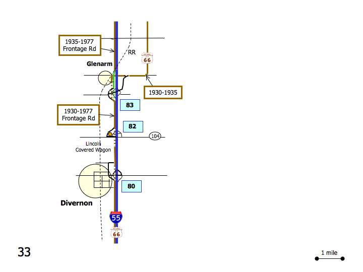
Continue south on Old Route 66. Curve right (=west) on Old Route 66. GlenarmCurve left (=south) with Old Route 66. [connecting] Brutle Ln. is the original alignment, but it dead-end on I-55. It might well have connected with Main St. on the other side of I-55, but details are unclear. Cross over I-55. [connecting] Left after the on-ramp onto Frazee Rd. [connecting] |
Continued from Lake Springfield.
Continue south on Palm Rd. Pass under the bridge for Pullman Rd. Immediately right on Poneyshoe Ln. Left (=west) on Pullman Rd. Left (=south) on Old Indian Trail. Right (=west) on Covered Bridge Rd. At the parking lot: Continue south on Palm Rd. (frontage rd. to I-55). GlenarmContinue south on Palm Rd. (frontage rd. to I-55). Cross over the railroad. Continue as Pal Rd. Renames to Douglas St. Exact alignment here is unclear, a possible 1930s alignment might have been a block to the west on Main St. With Burtle Ave. connecting to the 1930’s alignment and then heading furthere south to reconnect. To get to Main St.: turn right on Judd St. or Rhodes Ave. Continue as Douglas St. Renames to Frazee Rd. Continue on Frazee Rd. around exit 83. [connecting] Straight across at the intersection with Horse Farm Rd./Old Route 66. [connecting] |
| Continue south on Frazee Rd. [connecting]
Curve with Frazee Rd. next to I-55. CimicContinue on Frazee Rd. as it swigns around exit 82 on I-55. [connecting] There is a short stretch of Road missing, so we’re force to use I-55. Left on Il-104. [connecting] Enter I-55 southbound at exit 82. [connecting] On your right is the alignment that’s not connected anynore on th enorthern end. Use exit 80 to leave I-55. [connecting] DivernonRight (=west) on Brown St. [connecting] Next left (=south)on the frontage rd. [connecting] This will dead-end, but leads to the alignment that’s not connected on the norther end. Turn right (=north) on Henriatta St. [connecting] Turn right (=east) on Ping Rd. [connecting] Turn left (=north) on Buch Creek Rd. Dead-end Continue as the frontage rd. runs next to I-55 and renames to Reichert Rd. |
||


