Turn by turn

Random point of interest
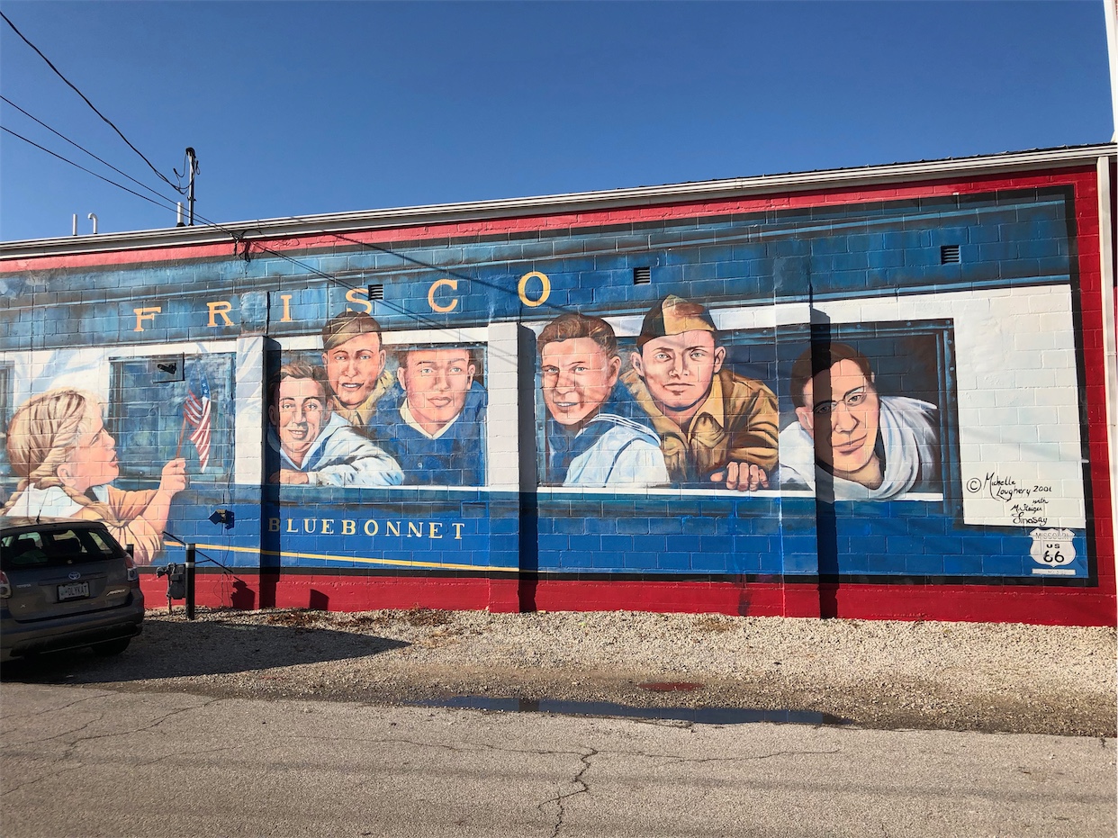
Gold Star Boys Mural
The Gold Star Mural just off Route 66 in Cuba was painted just after the tragedy ...
DetailNeedles – Barstow
CaliforniaPrinting this description can take a lot of time, so you might want to consider buying commercially available alternatives such as the 8 map set and the EZ66 guide to take along on your trip.
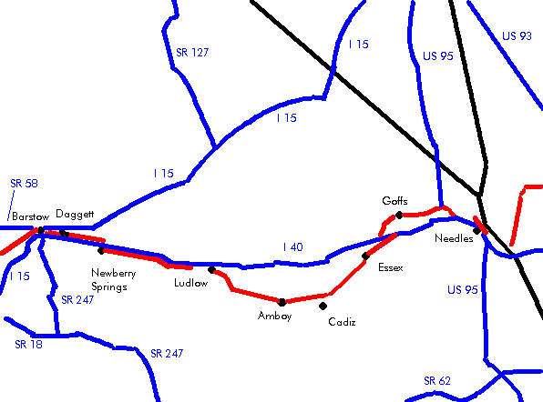
Needles
The rocky spines are what gave needles its name.
Mileage: 0
Enter California on I-40 (There’s not really much of an option here).
Continue at the first exit (Park Moabi Rd.)
Older alignments and bridges across the Colorado:
Exit at the first exit (Park Moabi Rd.
Turn north on Park Moabi Rd.
Pass over the railroad.
Just after the railroad to the right is the abandoned 1926-47 alignment, continue straight.
At the T intersection with National Trail Hwy:
East on National Trails Hwy. (Park Moabi Rd.) (1947-66 alignment)
Continue under the railroad underpass.
Continue under I-40.
At the south side of I-40 you’re at the west end of the former Red Rock Bridge. This is were the 1947-66 alignment entered California. It was an old Railroad bridge that was replaced in 1945 by the current bridge on the railroad you passed under on as you got here.
Continue on south on National Trails Hwy. towards the 1917 Old Trail Arch bridge. That bridge carried the 1926-1947 alignment.
The 1926-47 alignment ran along the banks and then up the hill (abandoned.)
Turn around and head back to the intersection north of the Moabi Rd exit.
West on National Trails Hwy.
This is a dead-end unless you’re in a vehicle capable of driving a sandy wash, in which case you could cross under I-40 and find the other side of the 1947-1966 alignment.
Return to the Moabi Rd. exit and join I-40 westbound.
Agricultural inspection station. In the days of the dust bowl there was not much needed to turn a family back by the bands of armed people guarding the crossing into California.
Leave I-40 at the second exit (Five Mile Station Rd.)
Turn left on Five Mile Rd. to cross I-40.
Just past the eastbound entry to I-40 turn left onto the dirt road. Do not enter when chances are it will rain!
Continue till the overlook on I-40.
Return (unless you’re driving a vehicle capable of driving a sandy wash in which case you could cross under I-40 towards the alignment on the other side).
Continue on National Trails Hwy as it turn right (northbound).
Parker Junction
Continue right on US-95 (north).
Cross under I-40 at the US-95 exit (Broadway)
Needles
Gas: fill up in Needles, after Needles you’re in the desert for many miles. Gas stations are far in between and not from major brands if that’s a concern for you.
Enter Needles on Broadway St. (US-66)
66 Motel
The covered wagon in the median. Once a sign for the El Rancho hotel, now welcoming visitors to needles.
At the fork with Front St.:
| older alignment | newer alignment |
|---|---|
|
Avoid Broadway St, keep right on Front St. Old Tails Inn, formerly the Palms Motel. (closed) Turn left on on F St. Turn right on Quinn Ct. Turn right on G St. Turn left onto Front St. At this one block jog to the left and back is the park in front of the El Graces hotel, an historic Harvey House. (closed) Needles Regional Museum at 923 Front St. the plaque of the REd Rock Bridge is on display here. Turn left onto L St. Turn right onto Broadway St. |
Continue left into Broadway St. |
|
continue |
|
Follow Broadway St. over the railroad overpass
Turn left (=west) onto Needles Hwy. (West Broadway St., US Historic Route 66).
Follow as Needles Hwy. crosses under I-40.
Follow as curves northwest
Cross over I-40 at the River Rd. exit.
The next right street is called Route 66 Pl., a dead-end.
Turn left at the Y-intersection onto National Old Trails Highway 0.5 miles beyong the last off ramp.
Turn left onto Park Rd.
Join I-40 westbound at the River Rd. Cutoff exit.
Continue on I-40 westbound.
| Pre 1931 | Post 1931 Goff bypass |
|---|---|
|
Leave I-40 at the US-95 exit. Head north for 6 miles on US-95 Arrowhead JunctionTurn left (=west) at the intersection of US-95 and Goffs Rd. (US Historic Route 66). Continue for 14 miles west on Goffs Rd. Cross the railroad tracks GoffsTurn left as Goffs Rd curves to the left. Goff’s Schoolhouse: preserved by the Mojave Desert Heritage & Cultural Association. Located at 37198 Lanfair Rd. FennerContinue on Goffs Rd. Cross under I-40. At the junction with the National Old Trails Highway, turn right as the post 1931 alignment rejoins from the left. |
Leave I-40 at the Mountain Springs Rd. exit. Cross over I-40. Continue for 11 miles on the National Trails Highway. Cross the railroad. Continue as the pre 1931 alignment rejoins from the right at the intersection with Goffs Rd. |
|
continue |
|
Continue on National Old Trails Highway.
Essex
Continue straight at the intersection with Essex Rd.
Sidetrip:Northwest of Essex are the Mitchell Caverns (in the Providence Mountains State Park).
Continue on National Old Trails Highway.
Danby
Continue straight at the intersection with Danby Rd.
Danby itself is at the railroad to the left.
Continue on National Old Trails Highway.
Summit
Continue on National Old Trails Highway.
Chambles (Cadiz)
Cadiz itself is to the south at the railroad.
Continue on National Old Trails Highway.
Graffiti made by turning the lava rocks on the right of the road.
Amboy
Amboy got sold in may 2005 to Albert Okura (owner of the Juan Pollo Restaurants) and the plans include preserving and restoring the city.
Roy’s Cafe. The previous occupants were not really open to roadies, and only catered to the movie industry. The new owners seem to be much more promising (spring 2005) and plan to restore and reopen the place in its former glory.
Amboy school (closed).
Cross the railroad tracks
Amboy crater to the left.
Amboy was once for sale on eBay.
Sidetrip: Joshua Tree National Monument to the south of Amboy
Continue on National Old Trails Highway.
Bagdad
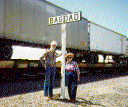
All that is left are a few pieces of concrete and one tree. Bagdad once had all a small town could have but was neglected after the mines closed and eventually razed during the construction of a pipeline when bagdad was used to store equipment.
Continue on National Old Trails Highway.
While the original Bagdad Cafe was in this town, the one used during the filming of the cult movie is in Newberry Springs.
Siberia
Continue on National Old Trails Highway.
Klondike
Continue on National Old Trails Highway.
Cross the railroad tacks as you approch I-40.
Ludlow
Continue on National Old Trails Highway.
Old Ludlow Cafe
Turn right (north) onto Crucero Rd.
The northern frontage road isn’t really Route 66. The old road ran to the south of I-40, to intersect with I-40 a mile or so westwards.
Route 66 Continued straight at the Crucero Rd. intersection straight onto Ludlow Rd.
Sidetrip: Ludlow Mercantile Company building to the south on Main St. near the railroad tracks.
Pass under I-40 at the Ludlow exit.
Turn left (west) onto the northern frontage road.
After almost 2 miles, Route 66 is again under your wheels. (the slightest of turns to the right is where).
The 2 lane got under and to the south of I40 for a brief moment, but there’s no way to follow it now.
Turn left at Lavic Rd. (after 8 miles).
Cross over I-40.
Turn right to stay with the National Old Trails Highway.
Newberry Springs
Abandoned Withing Bros. gas station.
Continue on National Old Trails Highway.
Continue at the Hector Rd. exit on National Old Trails Highway.
Continue at the Fort Cady Rd. exit on National Old Trails Highway.
Bagdad Cafe, where the movie was made.
West of town, cross I-40 as National Old Trails turns under I-40.
Continue west paralleling I-40.
Former state agricultural inspection station 6 miles beyond I-40 (1930-53).
Continue across Hidden Springs Rd. on the National old Trails Highway near the Barstow-Daggett Airport exit.
Abandoned solar concentrator on the right.
Daggett
Continue on Route 66 (National Old Trails Highway) accross A St./Daggett Yermo Rd.
Under the curved roof on the southwest corner was the 1930’s Cafe.
Across the tracks is the to be restored Stone Hotel, at an earlier route than Route 66 north of the tracks.
That Calico Ghost Town you’ve heard about by now, is to the north for about 7 miles.
Beyond Daggett, continue west paralleling I-40.
Join I-40 at the Nebo Rd. exit, a marine base blocks old 66.
After 2 miles, use the exit for the Marine Corps Logistics Base.
Turn left from the off-ramp.
Pass under I-40.
Turn right onto E. Main St. (U.S. Historic Route 66)
