Turn by turn
Random point of interest
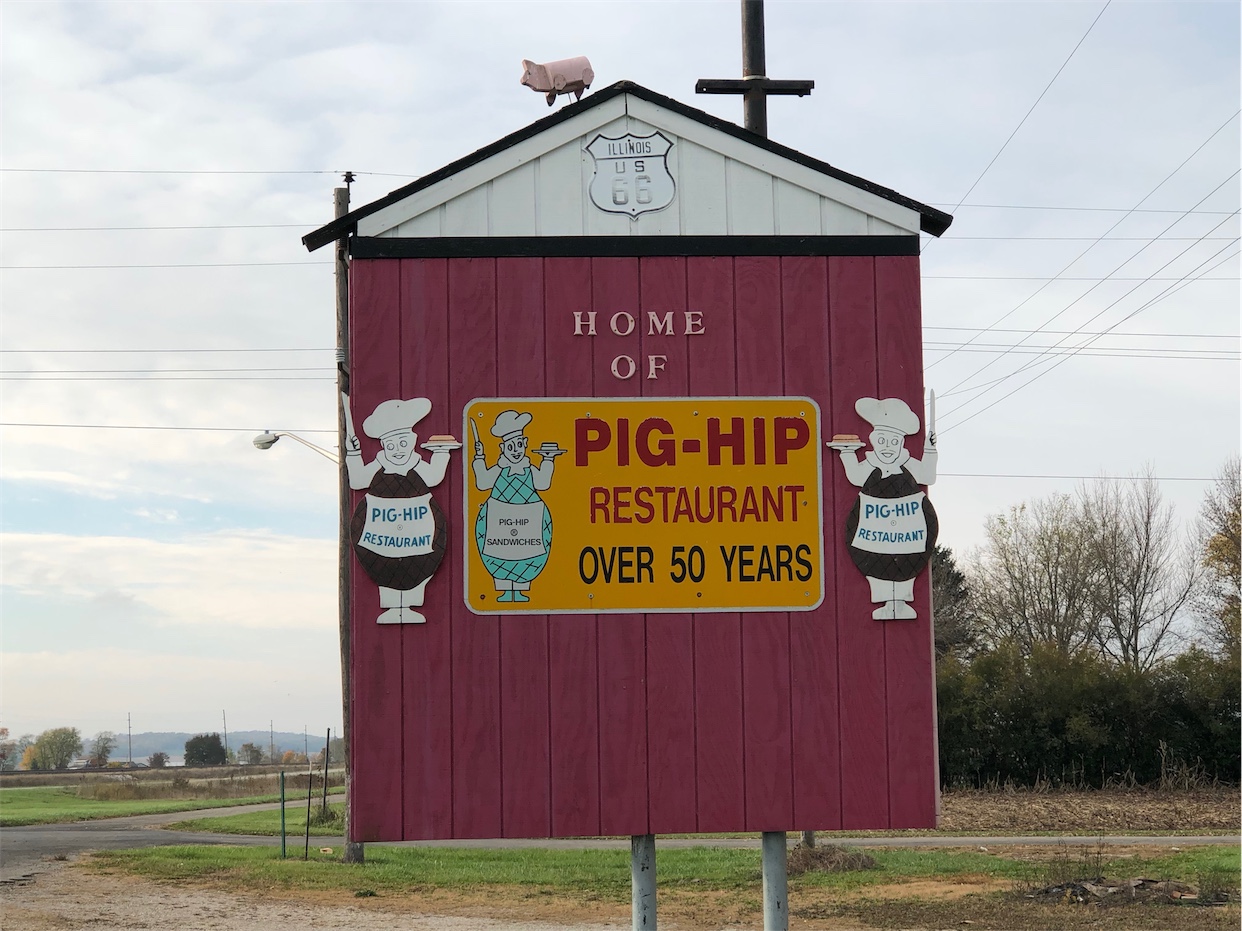
Pig Hip Restaurant Memorial
This icon on Route 66 was opened from 1937 till 2007. Before it was burned down in 2007 it ...
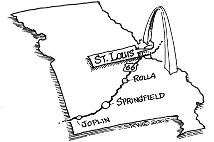
DetailSpringfield – Joplin
MissouriPrinting this description can take a lot of time, so you might want to consider buying commercially available alternatives such as the 8 map set and the EZ66 guide to take along on your trip.
Springfield
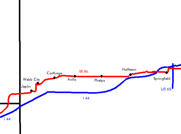
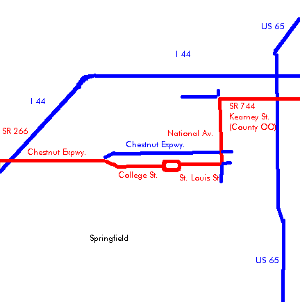
Enter Springfield on Kearney St. (MO-744).
Cross Schoolcraft Frwy. (US-65).
At the intersection with Glenstone Ave. (BL-44):
| city (1926-1935) | bypass (1936) |
|---|---|
| Turn left (=south) onto Glenstone Ave. (BL-44).
Location of the demolished Skyline Motel (winter 2004). Continue straight (=south) onto Glenstone Ave (US-65 Business Route) a the intersection with Chestnut Expwy. (US65 Business Rote, BL-44). Turn right (=west) onto St. Louis St. Continue as Saint Louis St. becomes Park Central E. Gillioz Theatre at 325 Park Central East, renovated in 2006. It originally opened October 12, 1926 (a day after Route 66 was named). Continue straight across Park Central Sq. onto Park Central W. Continue as Park Central W. becomes College St. Straight across Kansas Expwy. (MO-13). Continue as College St. veers right (=northwest). Turn left onto Chestnut Expwy. (BL-44). |
Continue straight on MO-744 (Kearney St.).
Turn left onto US-160 (W. Bypass). Turn right onto Chestnut Expwy. (MO-266, BL-44). |
| continue | |
Continue straight across US-160 West Bypass onto Chestnut Expwy. (MO-266,BL-44).
Cross I-44 at exit 72.
Continue west on MO-266 (Historic US-66).
Another alternative through Springfield:
Turn south on MO-125 in Strafford
Turn right on division St. (MO-YY).
Turn left onto Glenstone Ave.
Right on St. Louis St.
Continue as described for the City Alignment.
Elwood
Continue west on MO-266 (Historic US-66).
Halltown
Halltown has a lot of antique shops, like the White Hall store.
Continue west on Main St. (MO-266).
Paris Springs
Continue straight on Historic Route 66 as MO-266 turn left onto MO-96.
After 1.5 miles, continue straight across MO-96 onto MO-N (Historic Route 66).
Spencer
Continue on MO-N (Historic Route 66) for 0.5 miles.
Turn right onto Farm Rd. 2062 Lc (Historic Route 66).
take the historic loop through Spencer
After 1.2 miles, cross MO-96 onto the north frontage road (Farm Rd. 2059).
Straight at the intersection with MO-M onto Farm Rd 2059.
Rejoin MO-96 (also MO-M) westbound as the frontage road ends.
Continue straight at the intersection with MO-M onto MO-96.
Heatonville
Head due west on MO-96
Albatross
Head due west on MO-96
Continue straight across MO-39.
Phelps
Continue straight at the intersection with MO-UU.
Head due west on MO-96
Continue straight across MO-97.
Rescue
Head due west on MO-96
Continue straight at the intersection with MO-YY.
Continue straight at the intersection with MO-AA.
Plew
Continue straight at the intersection with MO-U (Lawrence County Ave.).
Log City
Only remains are left.
Head due west on MO-96
Stone City
Only remains are left.
Head due west on MO-96
Avilla
Continue straight as MO-37 joins from the right at an intersection in town.
Continue straight as MO-37 leaves to the left at an intersection beyond town.
Head due west on MO-96
Forest Mills
Head due west on MO-96
Continue straight at the intersection with MO-BB.
Maxville
Turn left (=south) onto Country Road 118.
Turn immediately right (southwest) onto Old 66 Blvd.
Carthage
Continue straight at the intersection with Country Rd. 120.
Continue slight right at the intersection with Country Rd. 130.
Turn left (=southwest) at the intersection with MO-96 (Easterly Dr., Willow St.).
Follow MO-96 over the railroad tracks.
Follow MO-96 (=west) onto Central Ave.
Straight across Main St.
Turn left (=south) onto Garrison Ave. (MO-571)
Boots motel: This landmark motel on the right was closed and threatened with destruction to make place for commercial development (2003).
2 blocks further, turn right onto Oak St.
Cross US-71.
See dead-end Route 66 alignment to the right (=northeast) 0.3 miles after US-71. The original Route 66 went behind the Route 66 Drive-In to come back in front.
Route 66 Drive-In: Originally built in 1949, and reopened in 1998 after being used as a salvage yard.
Turn slight left onto Old 66 Blvd. 0.5 miles after the crossing of US-71.
Brooklyn Heights
Continue on Old 66 Blvd. (Hosta Ln.)
Continue on across MO-171 (US-71 business loop) on Old 66 Blvd.
Turn slight right (=north) at the intersection with Hyacinth.
Turn next left (=west) onto Old Route 66 Blvd.
Dead-end section of Route 66 to the right (Index Rd.)
Carterville
Turn left (=south) at the T intersection with Pine St.
Turn right (=west) onto Main St. (MO-HH).
Turn left (=south) onto Carter St. (MO-HH)
Follow right (=west) with MO-HH at the intersection with Lewis St.
Webb City
Keep left onto Broadway St.
Straight across Main St. (MO-D).
Turn left onto Webb Ave.
Turn immediately right onto Broadway St.
Turn left (=south) onto Madison St.
Straight at the intersection with MO-171 and US-71 Business Route onto Madison St. (US-71 Business Route).
Joplin
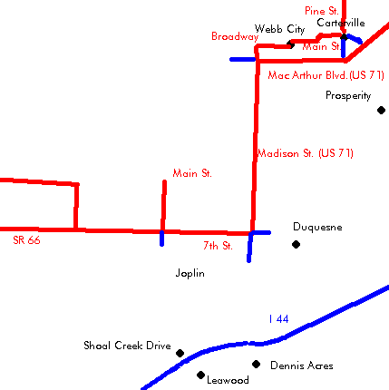
Enter Joplin on Range Line Rd. (US-71 Business Route).
At the intersection with Zora St.:
| city | bypass |
|---|---|
| Turn right (=west) onto Zora St.
Turn left (=south) onto Florida Ave. Turn right (=west) onto Utica St. Turn slight left (=southwest) onto Euclid Ave. Dale’s Old Route 66 Barber Shop on the corner of Utica St. and Euclid Ave. Turn left (=south) onto Saint Louis Ave. Turn right (=west) onto 7th St. (MO-66, BL-44). |
Continue straight onto Range Line Rd. (US-71 Business Route).
Continue straight as the road renames to Range Line Rd. (US-71 Business Road). Turn right (=west) at 7th St. (MO-66, BL-44). |
| continue | |
Continue straight across at the intersection with Main St. (MO-43) onto 7th St. (MO-66). Do not follow BL-44 as it turns south here.
Continue on the 4 lane MO-66 (7th St.).
Straight across Malang Rd.
At the next intersection:
| 2 lane | 4 lane |
|---|---|
| Turn right onto Old Route 66 (Old Route 66 Blvd.). | Continue straight on MO-66 into Kansas. |
